
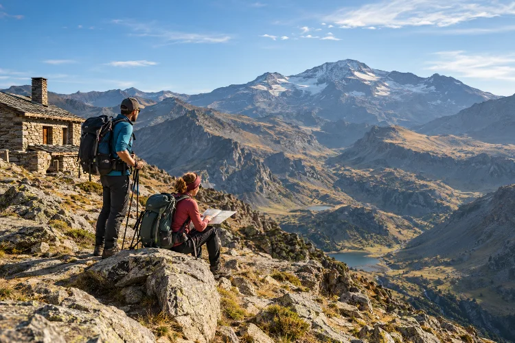
Sierra Nevada looks deceptively approachable from Granada. On a clear day, its broad ridges seem almost gentle, and summer access can bring hikers surprisingly close to the high mountains.
Once you move above 3,000 metres, however, the landscape becomes a very different environment. Planning advanced hiking routes in Sierra Nevada National Park requires more than downloading a GPX track and checking the distance.
Mulhacén, the highest summit on the Iberian Peninsula, reaches 3,479 metres, while the surrounding high country includes exposed ridges, glacial valleys, remote shelters, snowfields, and long sections with little protection from wind or sun.
A route that looks manageable on paper can become difficult because of elevation gain, altitude, heat, lingering snow, water availability, or changing weather.
The goal is not simply to choose the biggest summit. Good advanced-route planning means matching terrain, season, transport, fitness, navigational ability, and escape options before you start walking.
Choose the Route by Difficulty, Not Just Summit Name
Mulhacén and Veleta attract most of the attention, but reaching a famous summit is not automatically the best objective.
Start by comparing total distance, ascent, descent, maximum altitude, terrain, estimated moving time, and the availability of bailout routes.
An 18-kilometre hike with 1,500 metres of climbing is completely different from an 18-kilometre traverse that follows an elevated ridge.
Sierra Nevada’s official trail network includes routes through very different landscapes, from traditional paths beginning in mountain villages to high-altitude itineraries across the main massif.
Trevélez to Siete Lagunas is a useful example. The official park listing gives approximately 8.35 kilometres one way, around four and a half hours, and a high difficulty rating.
For advanced hikers, numbers like these should be starting points rather than promises. Add time for navigation, photography, altitude effects, food stops, and unexpected terrain.
Treat Altitude as Part of the Route
Distance becomes less useful as a planning metric when your route climbs above 3,000 metres.
Sierra Nevada contains the highest mountain on the Iberian Peninsula, with Mulhacén reaching 3,479 metres. Even strong lowland hikers may notice slower pacing, heavier breathing, reduced appetite, headaches, or poorer recovery at these elevations.
Do not automatically build your first high-altitude day around maximum vertical gain.
If possible, spend some time at moderate elevation before attempting the highest routes. Start slowly, drink regularly, and avoid setting a pace based entirely on your speed at sea level.
Altitude symptoms should not be treated as something to “push through.” If symptoms become significant or worsen while climbing, descending is the sensible response.
This is one reason a flexible itenerary is more valuable than an ambitious fixed schedule.
Use Different Trailheads Strategically
Where you start can completely change the character of a Sierra Nevada hike.
The northern approach around Hoya de la Mora provides access toward Veleta.
During the summer season, the park’s High Peaks Interpretation Service has operated transport from Hoya de la Mora toward Posiciones del Veleta at roughly 3,100 metres, creating access to several high-level routes.
On the southern side, Capileira provides one of the major gateways toward Mulhacén and Refugio Poqueira. The official park information point is connected with seasonal high-mountain minibus services that reduce some of the approach distance.
Do not build your entire plan around these services without checking them immediately before travelling. High-mountain buses and summer lifts are seasonal, and operating dates can change.
The same summit approached from another valley may create a significantly longer and more demanding hike.
That flexibility is useful. Instead of asking, “How do I climb Mulhacén?” ask, “Which Mulhacén route matches my available daylight, fitness, season, and transport?”
Build Multi-Day Routes Around Refuges Carefully
For longer traverses, Sierra Nevada’s refuge network can turn one extreme day into a more manageable mountain journey.
La Carihuela bivouac shelter sits at approximately 3,025 metres near the Collado del Veleta. It is ungarded, open year-round, and officially listed with space for 16 people.
The park identifies it as a support point for Veleta, Cerro de los Machos, the Veleta-Mulhacén-Caballo traverse, and the Integral de Sierra Nevada.
La Caldera is another ungarded shelter, located at about 3,050 metres and commonly used for Mulhacén and high-level traverses. It also has 16 places.
These shelters should be treated as basic emergency-style mountain infrastructure, not guaranteed accommodation.
Never plan as though a bed will definitely be available. Carry the equipement necessary to remain safe if the shelter is full, inaccessible, or unsuitable.
Water also requires planning. Official information for La Carihuela and La Caldera recommends treating water collected from nearby natural sources.
Understand the Rules for Bivouacking
A multi-day hiking route does not mean you can pitch a tent wherever you like.
Sierra Nevada permits certain forms of bivouacking and overnight camping associated with mountain traverses, but they are regulated.
Current Junta de Andalucía rules require prior communication for normal bivouacking or lightweight overnight camping, while larger groups may require formal authorization.
The rules also restrict camping close to towns, tourist accommodation, or refuges, and generally do not allow staying more than one night in the same place.
This matters when planning an advanced traverse because your overnight position should not be improvised at sunset.
Decide beforehand whether you will use a staffed refuge, an ungarded shelter, or a legal bivouac plan. Then verify current regulations directly with the park before departure.
Leave-no-trace principles are particularly important at high elevation, where vegetation can be fragile and recovery from damage is slow.
Check Snow and Weather, Even Outside Winter
One of the biggest mistakes in Sierra Nevada is assuming southern Spain means easy mountain weather.
High elevations can remain cold and exposed even while Granada is hot. Snow may persist on shaded terrain well beyond winter, while strong winds can turn otherwise straightforward ridges into unpleasant or unsafe environments.
Winter changes the nature of many routes completely.
A summer walk can become a mountaineering objective requiring appropriate technical equipment and experience.
If your planned route crosses hard snow or ice and you do not already have the necessary skills, changing the route is better than trying to learn them halfway up the mountain.
Check an official mountain-weather forcast shortly before departure, then reassess it again on the morning of the hike.
Do not focus only on rain probability. Wind speed, temperature, freezing level, visibility, storms, and expected cloud development can be more important above 3,000 metres.
Carry Navigation That Does Not Depend on Phone Signal
Advanced hikes require more than a single navigation app.
Download your route for offline use, but also carry a reliable topographic map or another independent navigational option. The park’s refuge information, for example, references Spain’s IGN 1:25,000 mapping for high-mountain sectors around Veleta, Mulhacén, and Trevélez.
Before starting, identify major terrain features rather than simply following a line on a screen.
Know which valley should be below you, which ridge you are crossing, where the nearest safe descent lies, and at what point continuing becomes a bad decision.
Create turnaround times too.
If reaching a summit at 3 p.m. means completing several exposed hours after sunset, the summit is no longer the sensible objective.
Strong navigaton is often less about knowing where to go and more about recognizing early when your original plan should change.
Plan Water More Conservatively Than You Think
High altitude can make Sierra Nevada feel cool, but sun exposure and dry air can increase dehydration quickly.
Natural water availability is seasonal and should never be assumed from an old trip report.
For example, the park notes possible summer water near La Carihuela and La Caldera but specifically recommends filtration or purification.
Carry enough capacity to survive longer dry sections than expected.
Also think about where your next reliable source is located rather than simply asking whether water exists somewhere along the route.
This becomes particularly important on ridge traverses. Dropping several hundred vertical metres to find water can transform an already demanding day.
Food planning works similarly. Advanced routes benefit from small, easy-to-eat foods that remain appealing when altitude or heat reduces your appetite.
Create a Primary Route and a Lower-Risk Alternative
A strong mountain plan should contain at least two versions.
Your primary plan might be a high traverse between Veleta and Mulhacén. The alternative could remain lower, turn around at a refuge, or use a valley route when wind, visibility, snow, or fatigue makes the higher objective unreasonable.
For a southern approach, Capileira to Refugio Poqueira provides a useful staged option. The official route climbs through Hoya del Portillo, Puerto Molina, and Alto del Chorrillo before descending toward the refuge.
From Trevélez, Siete Lagunas offers another demanding mountain day without requiring an immediate commitment to a major summit traverse.
Changing plans is not a failed hike.
In advanced terrain, adaptability is part of successful route planning.
Knowing how to plan advanced hiking routes in Sierra Nevada National Park means thinking beyond summit height and trail distance.
Mulhacén, Veleta, Siete Lagunas, and the high refuges offer outstanding possibilities, but altitude, weather, snow, water, seasonal transport, navigational demands, and overnight regulations all affect what is realistic.
Build conservative timings, research your trailhead, carry independent navigation, identify escape routes, and make sure your backup plan is genuinely easier than your main objective.
Most importantly, check official conditions shortly before leaving. Mountain information can change much faster than an online hiking article.
Choose a route that gives you room to adapt rather than one that depends on every detail going perfectly. In Sierra Nevada, good planning is what turns a difficult hike into a rewarding mountain journey.
