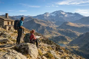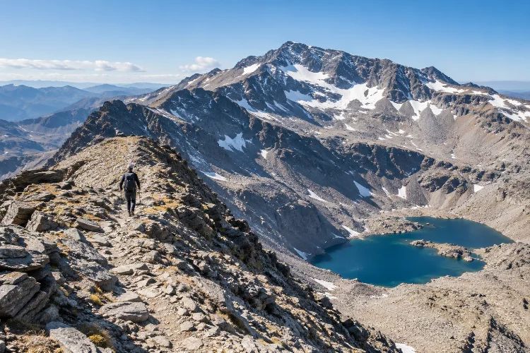
Standing at 3,479 metres, Mulhacén is the highest mountain on the Iberian Peninsula and the natural centerpiece of Sierra Nevada’s high country. Yet reaching the summit is only part of what makes this area worth exploring.
Some of the best high-altitude trails around Mulhacén Peak cross glacial valleys, alpine lagoons, broad ridges, old mountain tracks, and exposed terrain above 3,000 metres.
Routes can begin from Capileira, Trevélez, Hoya del Portillo, or higher seasonal access points, creating everything from demanding day hikes to serious multi-day traverses.
Sierra Nevada National Park has more than 450 kilometres of marked hiking itineraries across the wider protected area, while Mulhacén is surrounded by other major peaks, including Alcazaba and Veleta.
The important thing is choosing a trail that matches your experience. Altitude, snow, wind, navigation, water availability, and transport can turn an apparently straightforward summer walk into a much more serious mountian objective.
Start With the Southern Route From Capileira
For many hikers, Capileira is the most practical gateway to Mulhacén.
The official Hoya del Portillo–Refugio Poqueira itinerary climbs through Puerto Molina and Alto del Chorrillo before descending toward the Poqueira area.
The route gives increasingly wide views toward the southern face of Sierra Nevada and creates a useful approach to the higher trails around Mulhacén.
Hoya del Portillo is around 11 kilometres above Capileira and marks the point where normal vehicle access ends on this approach.
From there, experienced hikers can continue toward Alto del Chorrillo and eventually join the broad southern ridge known as Loma del Mulhacén.
This southern approach is popular partly because the terrain is generally less intimidating in dry summer conditions than the mountain’s steep northern side.
From the Poqueira area, the Loma route to the summit is listed at approximately 7.1 kilometres with around 1,100 metres of ascent and an estimated climbing time of 3.5-4 hours.
Do not confuse technically straightforward with physically easy, though. You will still spend hours above 2,500 metres.
Follow the Río Mulhacén for a More Dramatic Ascent
Another classic option climbs from the Poqueira side through the Río Mulhacén valley.
The route follows the river toward the Lagunillos del Majano before reaching the glacial basin of La Caldera. From there, hikers face the steeper western slope of Mulhacén.
Route information from Refugio Poqueira gives roughly 4.2 kilometres and 958 metres of ascent from the refuge area to the summit, taking around three to three and a half hours in summer conditions.
The most memorable section is around La Caldera.
The cirque contains a lagoon and the La Caldera bivouac shelter at about 3,050 metres. From here, the summit is clearly visible above a steep zigzagging trail. The final climb generally takes another hour to 90 minutes.
In dry summer weather, the challenge is mostly gradient, altitude, and loose mountain terrain.
In snow or ice, it becomes a different route entirely. Official route guidance warns that the western slope can be dangerous when iced, with crampons and an ice axe becoming essential for appropriately experienced mountaineers.
Explore Siete Lagunas From Trevélez
You do not need to summit Mulhacén to experience some of its finest high-altitude scenery.
The trail from Trevélez to Siete Lagunas is one of the strongest alternatives.
The official route climbs from the Alpujarran village toward Laguna Hondera, the lowest and largest of the seven glacial lagoons. The one-way trail is approximately 8.35 kilometres, takes around four and a half hours, and carries an official high difficulty rating.
Laguna Hondera sits around 2,900 metres above sea level.
That means the hike already delivers a genuine high-mountain experiance without requiring you to climb the final slopes of Mulhacén.
The landscape changes dramatically during the ascent. Irrigation channels, farms, and terraces around Trevélez gradually disappear, replaced by sparse alpine vegetation and glacial terrain.
Experienced hikers sometimes continue toward Mulhacén or connect Siete Lagunas with routes toward Alcazaba. Those extensions are considerably more demanding and require stronger navigation because you are moving beyond a simple out-and-back trail.
For a long high-altitude day with a beautiful destination, Siete Lagunas can be more rewarding than rushing directly to a summit.
Use La Caldera as the Hub of the High Country
La Caldera is more than somewhere you pass on the way to Mulhacén.
Its position at 3,050 metres makes it one of the most useful junctions in the high Sierra Nevada. The ungarded La Caldera bivouac shelter is permanently open and has capacity for 16 people.
The National Park identifies it as a base for climbing Mulhacén and Puntal de la Caldera, as well as a support point for the Veleta–Mulhacén traverse and longer Sierra Nevada crossings.
It should not be treated as guaranteed accommodation.
There are only 16 places, no rubbish collection, and no reservation system described for the shelter. In summer, water may be available from Laguna de la Caldera, but official guidance recommends filtering or treating it.
A strong advanced route can use La Caldera as a turning point rather than a sleeping destination.
For example, approach from Hoya del Portillo or Alto del Chorrillo, reach La Caldera, climb toward Collado del Ciervo for views of the dramatic north faces of Mulhacén and Alcazaba, and then decide whether conditions justify continuing to the summit.
This kind of flexible planning is far better than committing to a summit regardless of weather.
Add the Glacial Lagoons for a Wilder Circuit
For hikers who care more about landscape variety than ticking off a single peak, the high lagoons west and north of Mulhacén are particularly interesting.
A documented circular route from the Poqueira area links the Río Mulhacén, Laguna de la Caldera, Collado del Ciervo, Laguna de la Mosca, Juego de Bolos, Laguna Larga, Crestones de Río Seco, and Laguna de Río Seco.
The route information gives approximately 13.8 kilometres, around 1,280 metres of ascent, and roughly 5.5–7.5 hours.
This is much more than a casual lake walk.
Some sections pass through rougher high-mountain terrain near the northern side of the massif, where route-finding and changing conditions deserve serious attention.
The reward is variety. Instead of spending the entire day climbing one broad ridge, you encounter glacial cirques, isolated lakes, rocky crests, and close views of Mulhacén’s much steeper northern architecture.
It is an excellent choice for experienced hikers who have already climbed the peak and want to understand the surrounding landscape.
Consider the Veleta–Mulhacén Traverse for a Bigger Challenge
If a standard summit hike feels too limited, the traverse between Veleta and Mulhacén turns the outing into a genuine high-level journey.
The route crosses the core of Sierra Nevada and can use several bivouac shelters, including La Carihuela near Veleta and La Caldera closer to Mulhacén.
La Carihuela sits at approximately 3,025 metres, is open throughout the year, and has 16 places. The National Park specifically identifies it as support for long routes such as the Mulhacén–Veleta–Caballo traverse.
This type of itinerary should be planned differently from a normal summit day.
Your priorities become water, weather exposure, daylight, escape routes, navigation, and overnight arrangements. Much of the route stays near or above 3,000 metres, so even moderate wind can become exhausting.
It also makes sense to split a traverse into stages rather than chasing an aggressive time.
The high plateau may appear straightforward in clear summer weather, but cloud, snow, or strong wind can make orientation much harder.
Check the Current Poqueira Refuge Situation
Many older itineraries assume Refugio Poqueira is available for meals and overnight accommodation.
That assumption currently needs extra caution.
At the time of writing in October 2026, the official Sierra Nevada visitor portal still lists Refugio Poqueira as temporarily closed for renovation, with the closure notice dating from March 27, 2026.
That does not automatically mean surrounding trails are closed, but it changes logistical planning significantly.
Do not start a multi-day route assuming you can arrive there for a bed, dinner, water, or emergency assistance. Check the official park information shortly before departure because the reopening situation may change.
Seasonal SIAC minibuses from Capileira can also reduce the long southern approach by providing access toward the high country around Chorrillo, but this service is seasonal and should be confirmed before building it into your plan.
Transport information is one of the easiest parts of an online hiking guide to become outdated.
Treat Summer and Winter as Different Mountains
Mulhacén is often presented as a non-technical hiking peak, but that description only makes sense under suitable conditions.
During dry summer periods, routes such as Loma del Mulhacén can mainly demand fitness, altitude tolerance, sun protection, and competent navigation.
Add frozen snow and the risk profile changes completely.
Steep slopes around La Caldera and the north-facing terrain can require winter mountaineering equipment and the skill to use it. The difference between hiking boots and crampons is not simply a packing choice—it represents a completely different level of technical travel.
Summer also carries its own problems.
Shade is extremely limited above the tree line. Dry air, intense UV exposure, and long stretches between reliable water sources can lead to dehydration surprisingly quickly.
Carry more water than you would for an equivalent lenght of lowland trail, use sun protection, and start early.
Give Altitude More Respect Than Distance
Mulhacén’s 3,479-metre summit makes altitude one of the main factors on every route.
A trail may only have a few kilometres remaining, but walking above 3,000 metres can feel much slower than expected.
If you normally hike close to sea level, consider spending time at moderate elevation before attempting your longest route. Do not create a schedule that requires maintaining your normal low-altitude pace.
Headache, unusual fatigue, nausea, or worsening symptoms while ascending deserve attention.
Turning around because your body is not adapting well is better than treating the summit as mandatory.
The best trail is ultimately the one you can complete safely while still enjoying where you are.
Exploring the best high-altitude trails around Mulhacén Peak offers far more variety than a simple up-and-down summit hike.
The Loma del Mulhacén provides a classic southern approach, while the Río Mulhacén route passes through the impressive La Caldera cirque.
Trevélez to Siete Lagunas delivers a demanding glacial-lake journey, and experienced hikers can expand the adventure into lagoon circuits or a Veleta–Mulhacén traverse.
Whichever route you choose, let current conditions decide the final plan. Check refuge and minibus status, download reliable mapping, carry enough water, and treat snow-covered terrain as mountaineering rather than summer hiking.
Mulhacén may be the headline summit, but the real attraction is the entire high-altitude landscape surrounding it. Give yourself enough time to explore that landscape rather than simply collecting the peak.