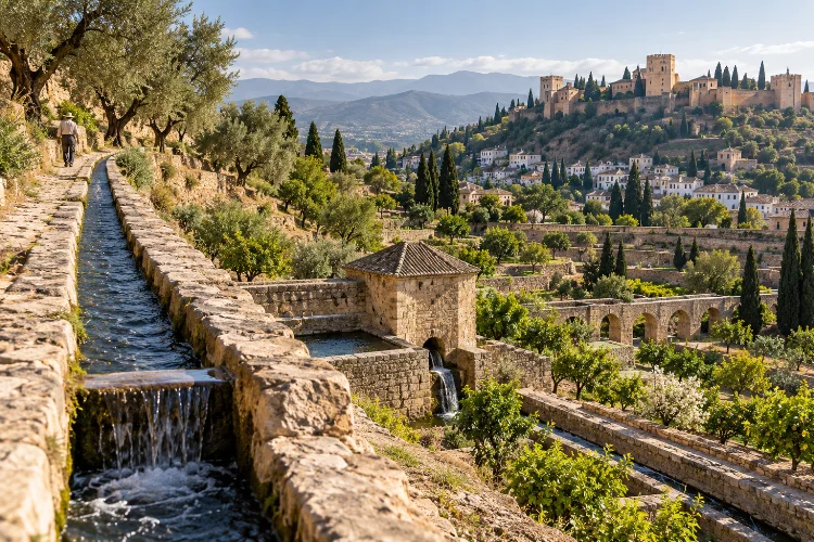
Water might seem abundant when you stand beside the fountains of the Alhambra or walk through a green Andalusian courtyard.
Step back from those beautiful scenes, however, and a more complicated question appears: how did medieval communities move enough water across dry hillsides to support cities, orchards, farms, baths, and palace gardens?
The answer lies partly in the sophisticated hydraulic traditions developed across Al-Andalus.
Muslim communities did not invent irrigation from nothing – Roman, Mediterranean, and earlier technologies already existed – but they expanded, organized, and adapted water-management systems to suit southern Spain’s geography and climate.
Understanding how Moorish water engineering influenced Andalusian landscapes means following networks of acequias, dams, cisterns, pools, wells, waterwheels, terraces, and distribution channels.
In Granada alone, these systems helped shape both the city and its surrounding agricultural plain. At the Alhambra and Generalife, UNESCO describes irrigation engineering as essential to the integration of architecture, productive gardens, and landscape.
Acequias Turned Gravity Into an Engineering Tool
The acequia is one of the most important elements of Andalusian hydraulic heritage.
Essentially an artificial water channel, an acequia carries water from a river, spring, or mountain source toward settlements and cultivated land. The clever part is that many systems rely largely on gravity rather than mechanical pumping.
Engineers needed to calculate gradients carefully. Too steep, and water could erode the channel or rush past fields too quickly. Too shallow, and the flow might stop.
Granada’s Acequia Real provides a remarkable example. Created during the Nasrid period, it diverted water from the Darro River at a point higher than the Alhambra and carried it toward the Generalife before supplying the palatine city.
The official Alhambra authority describes the canal as the main artery of a larger network serving palaces, baths, mosques, houses, cisterns, fountains, gardens, farming, and crafts.
What appears today as a peaceful garden channel was therefore part of serious urban infrastructure.
Water Engineering Made the Alhambra Possible
The location of the Alhambra makes its water system even more impressive.
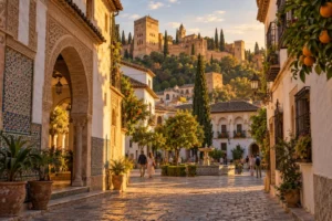
The palatine city stands on Sabika Hill, above the natural course of the Darro. Building an elaborate royal complex there required a dependable supply of water at elevation.
The Nasrid solution involved diverting the Darro upstream and guiding water gradually toward the hill through the Acequia Real.
Official Alhambra research notes that the main medieval channel travelled more than six kilometres from its intake before reaching the monumental complex.
Once there, water entered an increasingly complex network of smaller channels, cisterns, pools, and storage systems.
The nearby Albercones demonstrate how engineers dealt with land above the normal canal level. Water passed through an underground gallery to a well, where a waterwheel could lift it toward a large reservoir serving higher cultivation areas.
That system changed the entire enviroment. A dry hill became capable of supporting residences, workshops, baths, orchards, fountains, and ornamental gardens.
The Generalife Blurred the Line Between Garden and Farm
Visitors often think of the Generalife mainly as an elegant royal garden.
Historically, it was also productive land.
UNESCO describes the Generalife’s gardens and vegetable farms as rare surviving examples of medieval agricultural productivity associated with the Nasrid palatine landscape.
Water engineering connected these productive areas with the royal residence, turning irrigation infrastructure into part of the overall architectural composition.
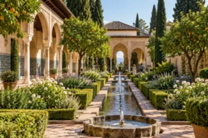
The same water could irrigate vegetables and fruit trees before entering more formal settings.
That helps explain why historic Islamic gardens should not be understood as decoration alone. Orchards could provide food while also producing shade, fragrance, and pleasant views. Channels used for irrigation could become visual axes through courtyards.
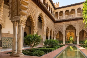
The famous Patio de la Acequia makes that connection especially clear. Its long central channel is visually striking, but it belongs to a much wider hydraulic tradition rather than existing simply as a fountain feature.
The official Alhambra authority identifies the Royal Canal as the principal hydraulic source of the complex.
Engineering and landscape design were essentially working together.
Irrigation Reshaped Granada Far Beyond the Palace
The Alhambra was not an isolated hydraulic achievement.
Medieval Granada and its surrounding vega, or fertile agricultural plain, were crossed by an extensive system of canals.
According to the Patronato de la Alhambra, Hispano-Muslim irrigation networks in the region were documented as early as the tenth century and remained substantially in use until the twentieth century.
These networks contained much more than simple ditches.
Dividers controlled how much water entered different branches. Spillways prevented excess flow. Diversions sent water toward particular farms, neighborhoods, mills, or settlements.
Water infrastructure therefore influenced where people could cultivate land and where communities could grow.
Government heritage documentation for Granada’s Darro Valley similarly describes medieval hydraulic infrastructure – including dams, canals, aqueducts, reservoirs, cisterns, and fountains—as a major element structuring the wider territory.
The physical landscape of Granada was partly a water map.
Follow the historical channels and you begin to understand why orchards, neighborhoods, paths, and productive zones developed where they did.
Terraces and Acequias Transformed Mountain Landscapes
The influence becomes even more obvious outside the major cities.
In the Alpujarras, on the southern slopes of the Sierra Nevada, communities developed agricultural landscapes built around terraces and intricate acequia networks. Water from high elevations could be guided across slopes and distributed among small cultivated plots.
These systems made difficult mountain terrain more productive.
Andalusian heritage authorities note that traditional acequias remain fundamental to the agricultural landscape of the Alpujarra Media. They define irrigated areas, support terraced plots, supply settlements, and historically provided water for livestock and small-scale industrial uses.
Managing the system was also a social activity.
Water had to be divided among users, channels cleaned, damaged sections repaired, and schedules respected. Traditional irrigation communities and specialist acequieros helped coordinate that process.
So Moorish-derived irigation heritage did more than alter terrain. It encouraged systems of shared resource management that survived long after medieval Muslim rule ended.
Reservoirs, Cisterns, and Dams Made Water More Reliable
Moving water is only one part of hydraulic engineering. Storing it matters just as much.
Medieval Andalusian landscapes used albercas – storage pools or reservoirs – and aljibes, or cisterns, to keep water available where and when it was needed.
At the Alhambra, storage pools were integrated into the wider channel network. Elsewhere, much larger hydraulic projects could transform entire agricultural zones.
Research published by Spain’s CSIC has examined a 12th-century Andalusi dam on the Trujala River in Jaén.
The structure created a reservoir that changed the surrounding landscape and supported an irrigated environment, illustrating how medieval water engineering could operate at more than a domestic or garden scale.
Medina Azahara near Córdoba offers another perspective.
Its tenth-century palatial complex incorporated sophisticated water supply and drainage infrastructure alongside formal gardens. UNESCO nomination research describes rectangular gardens divided by paved walks with irrigation channels supplied from pools.
This was landscape planning as much as engineering.
Water Became an Architectural Material
Perhaps the most beautiful legacy of Andalusian hydraulic technology is what happened after water reached its destination.
Instead of hiding it completely, designers often made water visible.
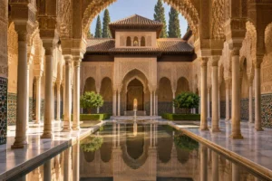
At the Alhambra, narrow channels connect rooms and courtyards. Pools mirror decorated façades. Small fountains produce gentle sound. Water flowing beside stairs adds movement to otherwise static architecture.
The Water Stairway at the Generalife is a particularly memorable example. Water from the Royal Canal still runs along channels built into the stairway’s parapets, combining circulation, landscape, sound, and hydraulic function.
UNESCO specifically recognizes the Alhambra and Generalife for the intelligent aesthetic use of water and vegetation.
This is where engineering becomes art.
A reservoir controls supply, but its surface can also reflect the sky. An acequia irrigates plants, but it can also organize a courtyard. A fountain distributes water while cooling the surrounding air and creating a distinct acoustic atmosphere.
The technical system never completely disappears behind the decoration.
Christian Andalusia Inherited and Adapted the Networks
The political end of Muslim rule did not mean the hydraulic landscape vanished.
Many irrigation systems were too valuable to abandon.
At the Alhambra, the official heritage authority notes that Christian administrators maintained the Moorish hydraulic system after the conquest, helping preserve its medieval operation.
Elsewhere, older channels continued serving agriculture and settlements while being repaired, expanded, renamed, or adapted for new crops.
That continous use makes the history more complicated than a simple “Moorish versus Christian” timeline. Infrastructure often survives political change because communities still need water.
The result is an Andalusian landscape made of historical layers.
A modern concrete section might follow a medieval canal route. A present-day orchard may still depend on water distribution patterns established centuries earlier. A famous palace fountain may ultimately be connected to a river several kilometres away.
Why This Water Heritage Still Matters Today
Historic acequias are more than picturesque remains.
Traditional open channels can interact with soils, vegetation, aquifers, and mountain ecosystems in ways that closed pipes do not. Their continued maintenance also preserves cultural knowledge about seasonal water availability and local geography.
The Alpujarra heritage designation emphasizes that its acequias belong to a wider agroecosystem connecting natural conditions, agriculture, settlement, and collective management.
They also provide a useful lesson for modern visitors.
When touring Andalusia, don’t look at a fountain as an isolated attraction. Ask where its water came from. When walking through a terraced valley, notice the narrow channels following the contour of the hillside.
Those small details reveal an enormous system hiding in plain sight.
Understanding how Moorish water engineering influenced Andalusian landscapes changes the way you see southern Spain.
Acequias moved water across difficult terrain, while reservoirs and cisterns stored it for cities and farms. Terracing transformed mountain slopes, irrigation networks supported the Vega of Granada, and sophisticated systems made places like the Alhambra and Generalife possible.
Water then became something more than infrastructure, shaping courtyards, gardens, fountains, agriculture, and even the sound of architectural spaces.
Much of this heritage survived because later communities continued using and adapting it. When exploring Andalusia, follow the water rather than only the monuments.
Look for channels beside paths, reservoirs above gardens, terraces on distant hillsides, and fountains connected to invisible networks. They reveal one of the region’s most influential engineering legacies.