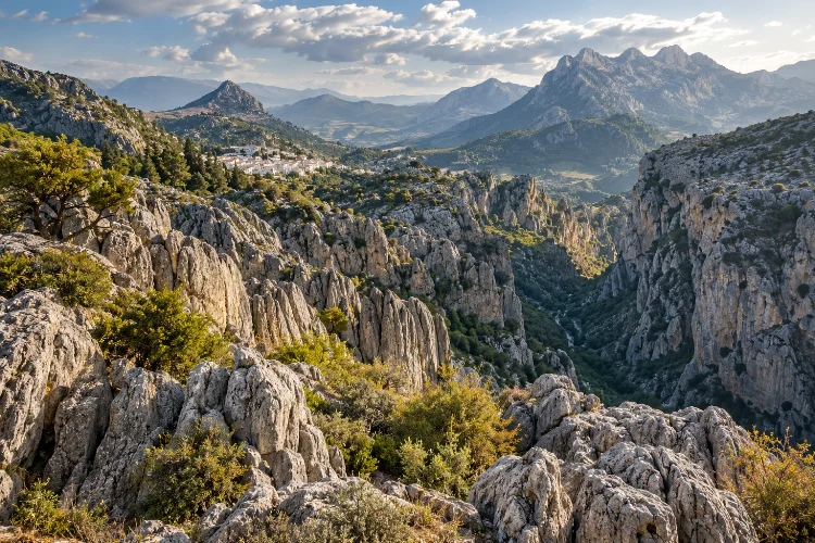
At first glance, Sierra de Grazalema looks like a collection of rugged grey mountains rising behind Andalusia’s white villages. Walk into the landscape, though, and the scenery becomes much stranger.
Limestone ridges break into sharp pinnacles, rainwater disappears underground, deep gorges slice through the mountains, and hidden caves extend beneath terrain that can look almost lunar.
Exploring the dramatic limestone landscapes of Sierra de Grazalema means discovering one of Spain’s most impressive karst environments.
The natural park covers more than 53,000 hectares across Cádiz and Málaga provinces, while its relief rises from surrounding valleys toward peaks around 1,600 metres. The area has been protected as a natural park since 1985 and was designated a UNESCO Biosphere Reserve in 1977.
What makes the Sierra particularly fascinating is the interaction between geology and water. Heavy rainfall slowly dissolves limestone, creating cliffs, sinkholes, caves, underground rivers, and narrow canyons that continue shaping the landscape today.
Limestone Is the Foundation of the Sierra
To understand Grazalema, start with the rock.
The massif lies in the western Betic mountain system and is dominated by limestone formations shaped by a long and complicated geological history.
Official Andalusian environmental information describes the park as a landscape of strongly contrasting relief formed over limestone.
Limestone reacts slowly with slightly acidic rainwater. Water enters cracks, enlarges them over thousands of years, and gradually creates the classic features of a karst landscape.
That process explains why the mountains rarely look smooth.
You will see deeply fractured rock, pinnacles, rounded depressions, sharp ridges, and surfaces covered with channels and grooves.
Around Llanos del Endrinal, for example, local tourism authorities highlight extensive limestone pavements, pinnacles, towers, and dolinas created through dissolution.
The result can look almost like another planet, particularly where vegetation becomes sparse and pale limestone dominates the view.
Rain Created a Landscape Full of Gorges and Caves
The amount of rain falling here surprises many first-time visitors.
Sierra de Grazalema is one of the wettest areas of the Iberian Peninsula, receiving more than 2,000 millimetres of precipitation annually in some sectors. Its position helps trap moist Atlantic air, producing far more rainfall than the stereotypical image of dry southern Spain suggests.
Much of that water does not simply flow across the surface.
It enters cracks in the porous limestone and moves underground. Over long periods, this drainage has produced an extensive network of chasms, caves, galleries, springs, and underground rivers.
Spain’s official tourism authority describes Grazalema as one of the country’s most spectacular karst complexes and notes that its system of underground cavities is among Andalusia’s most extensive.
That means the visible mountains are only half the story.
Beneath your feet, another hidden landscape exists.
Garganta Verde Reveals the Power of Erosion
Few places demonstrate the power of water better than Garganta Verde.
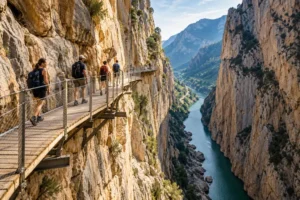
This narrow canyon was cut into limestone by the Bocaleones River. Its walls create around 400 metres of vertical relief in places, forming one of the most dramatic natural corridors in the park.
From above, the gorge appears like a giant crack splitting the mountains.
Inside, the scale changes completely. Vertical rock walls dominate the view, while vegetation clings to ledges and griffon vultures often circle above the canyon.
The route into Garganta Verde is more than a scenic hike. It provides a direct lesson in how running water can exploit weaknesses in limestone and gradually create enormous landforms.
Access can be regulated because of conservation and seasonal safety conditions, so always check current official park information before planning a descent.
Even if you never enter the gorge itself, nearby viewpoints help reveal just how deeply water has cut into the massif.
Underground Landscapes Can Be Even More Dramatic
Some of the Sierra’s most extraordinary limestone features are almost completely invisible from the surface.
The Hundidero-Gato system is a prime example. Water enters through the Hundidero area and moves through a major underground cave network before emerging again at Cueva del Gato.
Official tourism information identifies the complex as one of Andalusia’s outstanding cave systems.
Large bat populations also use the underground environment, adding important ecological value to the geologcal spectacle.
Nearby Cueva de la Pileta combines geology with human history. Its cave environment preserves prehistoric paintings, demonstrating that people have interacted with this limestone landscape for thousands of years.
Caving in the region should never be treated like ordinary hiking.
Many underground routes require specialist skills, equipment, permits, or experienced guides. A harmless-looking opening can lead into complex passages affected by water levels and difficult navigation.
For casual visitors, appreciating caves from designated visitor areas is the safer option.
The Sierra del Endrinal Feels Almost Lunar
If you want to see limestone erosion without entering a cave, Sierra del Endrinal is one of the best areas to explore.
The Llanos del Endrinal route passes through terrain where dissolved limestone has created extraordinary shapes. Rounded towers, grooves, pinnacles, depressions, and broad areas of exposed rock make the landscape feel unusually wild.
The area also demonstrates how people adapted to difficult mountain terrain.
Traditional stone enclosures associated with livestock remain visible among the karst formations. Grazing by breeds such as the Payoya goat and Merina Grazalemeña sheep has helped shape local mountain culture and food production.
That mixture makes the walk particularly interesting.
You are not exploring an untouched geological museum. You are moving through a cultural landscape where limestone, livestock, old paths, walls, and mountain communities have interacted for generations.
Wear sturdy footwear—the rocky surface can be rough and surprisingly uneven.
Limestone and Rain Helped Create the Pinsapo Forests
The grey rock may dominate the skyline, but Grazalema is also famous for an unusually green landscape.
One of its most important species is the Spanish fir, or pinsapo (Abies pinsapo). Significant populations survive around Sierra del Pinar, benefiting from cooler, wetter conditions on sheltered mountain slopes.
Spain’s official tourism site calls these relict fir forests one of the defining natural features of the reserve.
The contrast is striking.
Bare limestone ridges may rise directly above dense woodland, creating very different habitats within a relatively small area.
This diversity helps explain the park’s rich wildlife. Official sources record species including Spanish ibex, deer, golden eagles, peregrine falcons, and griffon vultures.
The pinsapo forests also show why geology cannot be separated from climate.
Rock type affects drainage and soil formation, while rainfall and slope orientation influence where forests survive. The entire enviroment works as one connected system.
Climb Higher to Understand the Scale of the Karst
Some geological features only make sense when seen from above.
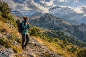
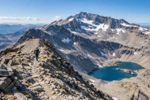
Peaks and high passes reveal how limestone ridges run across the Sierra, separated by valleys, depressions, and narrow corridors.
The park includes some of Cádiz Province’s highest terrain, and traditional mountain objectives include El Torreón and other summits around the central ranges.
From these elevations, villages suddenly seem tiny.
Grazalema, Benaocaz, Villaluenga del Rosario, and Zahara de la Sierra appear almost inserted between folds in the mountains. Roads twist around cliffs because the geology determines where movement is possible.
High routes can be demanding, however.
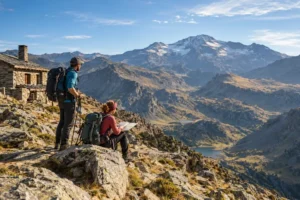
Loose limestone, steep gradients, strong sun, rain, fog, and slippery rock can all complicate apparently simple hikes. Grazalema’s high rainfall also means conditions can change more rapidly than visitors expect in Andalusia.
Choose routes according to experience rather than simply aiming for the highest viewpoint.
Explore the White Villages as Part of the Landscape
The geology does not stop when you reach a village.
Settlements throughout Sierra de Grazalema were shaped by the same mountains that attract hikers today.
Grazalema itself sits surrounded by limestone peaks, while Villaluenga del Rosario lies beneath dramatic rock formations and Zahara de la Sierra occupies a spectacular fortified hillside.
The natural park encompasses municipalities across both Cádiz and Málaga provinces, including Grazalema, Zahara, Benaocaz, Ubrique, Villaluenga del Rosario, Benaoján, Montejaque, and others.
Spend time looking at how these settlements fit into the terrain.
Roads often follow valleys or mountain passes. Springs historically influenced settlement locations. Stone from the surrounding landscape appears in walls and agricultural structures.
This connection is easy to miss if you treat the Pueblos Blancos as separate tourist attractions.
They are actually part of the same limestone landscape.
Choose Spring or Autumn for Comfortable Exploration
The Sierra can be explored throughout much of the year, but the experience changes dramatically with the seasons.
Spring combines green vegetation, flowing water, wildflowers, and generally comfortable hiking temperatures. Autumn is another excellent choice, especially once summer heat fades.
Summer can become very hot on exposed limestone. Pale rock reflects sunlight, shade can be limited, and water requirements rise quickly.
Winter brings rainfall, mist, colder conditions, and occasionally snow at higher elevations. That weather can make the scenery extremely dramatic, but wet limestone becomes surprisngly slippery.
Whatever the season, check current trail status before leaving.
Protected routes may have access restrictions, and heavy storms can occasionally damage paths or create temporary closures. Carry offline navigation, sufficient water, and layers appropriate for changing mountain weather.
Exploring the dramatic limestone landscapes of Sierra de Grazalema reveals a mountain environment shaped by far more than impressive scenery.
Rainwater has dissolved and fractured the limestone into gorges, sinkholes, caves, underground rivers, and strangely sculpted karst formations. Garganta Verde exposes the power of erosion, while Hundidero-Gato hides an entire subterranean world.
Above ground, the same geology supports rugged hiking terrain, rare pinsapo forests, wildlife, grazing traditions, and white villages carefully fitted into the mountains.
The best way to understand Grazalema is to explore at different scales. Walk across limestone pavements, look into deep valleys, study the mountains from a village street, and notice where water disappears underground.
Once you begin reading the rock, Sierra de Grazalema feels less like a collection of scenic peaks and more like one enormous evolving landscape.